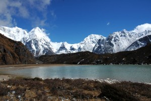
Two major river systems, the Arun and the Tamur, drain Nepal’s eastern ranges, upon which the monsoon unleashes its deluge with unparalleled vigour every summer. Like the Karnali river in the west, the Arun predates the Himalaya, and rises north of Everest, in Tibet (where it is called the Phung Chu), passing between the major mountain massifs of Kanchenjunga and Makalu, at an altitude of under 1000m, meaning that the valley floor is a veritable sauna even in November. From Makalu and the Arun valley to the tea estates of Ilam and the border with Sikkim, the lush, densely forested hills of eastern Nepal are mysterious, complex and thoroughly alluring. Deep, seemingly impenetrable valleys carve their way into the highlands from the south; primaeval, mist-swathed and alive with the chorus of birds and insects. In spring, mighty rhododendrons, magnolias and azaleas burst into flower, together with many varieties of orchid, colouring entire mountainsides with their vibrant, exotic hues. Here, you won’t find lodges advertising hot showers, but isolated pastoral villages. The Tamur and its major tributaries – the Yangma, Ghiunsa and Sumbua Kholas – drain the entire western side of the Kanchenjunga Himal, before combining with the Arun and the Sun Khose east of Dharan in the Mahabharat hills to form the Sapta Khosi. Thus, in effect one mighty stream drains this stretch of the Nepal Himalaya.
Kanchenjunga, at 8586 metres, is the world's third-highest mountain: it lies on the border of Nepal and Sikkim (India) and has several distinct summits. It is visible from Darjeeling, so many expeditions explored this region and tried to climb the mountain during the British rule in India. After partition, a British team led by Charles Evans (of Everest fame) made the first ascent of Kanchenjunga in 1955. They trekked from Manebhanjang, and climbed the south face of the mountain. Another spectacular peak in the region is Jannu (Khumbakarna), at 7710 metres. The Nepalese renamed this peak Khumbakarna in 1984 when a committee Nepalised the names of many peaks. Jannu was also called "Mystery Peak" and "Peak of Terror" by early expeditions. A French team made the first ascent of Jannu in 1962.
Eastern Nepal is characterised by hill ethnic groups different from those in the central and western regions, more development efforts in the hills, and perhaps a higher standard of living. Much of the difference is attributable to several factors. The east receives more rainfall generally, and this increases agricultural productivity; proximity to Darjeeling has always resulted in a greater awareness of the outside world; and the Gurkhas, the soldiers recruited for service in the British army, primarily came from four ethnic groups, two of which, the Rai and Limbu, are concentrated in this region. (Magar and Gurung, the other two, are from mid-west Nepal).As a consequence, the eastern Tarai was the first segment to be developed, large towns and cities appeared and continue to grow here, and construction on the East-West Highway was begun in the east. Air links were also concentrated here.
In the far north-east, impoverished communities of Bhotias eke out a marginal existence, grazing their animals on pastures that lie under deep snow for long months every winter. It is wild country where the inhabitants have maintained their links with Tibet and have shared in the region’s development to a lesser extent, still relying on tenuous economic links across difficult passes on the border with Tibet for their livelihood.
The allure of Eastern Nepal is in part because it is less visited by tourists, and the mountain scenery which offers new vistas. Trekking goals in eastern Nepal include Kanchenjunga and Makalu base camps, Milka Danda for flowering forests, the eastern approach to Everest, and one of the most challenging passes in Nepal, Sherpani Col which leads to the upper part of the Khumbu Valley. Most ethnic groups are represented here, and many villages, such as Dhankuta, Khandbari, Bhojpur and Khotang, are large, prosperous and clean. The area has hot, rice-growing districts and also encompasses the cooler tea-growing region of Ilam. The treks are also longer because it requires two weeks to travel from Dharan to the high mountains. There are far fewer of the trekker lodges and inns that characterize the region north of Pokhara, north of Kathmandu, and on the way to Everest.


